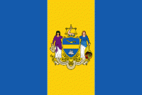
Philadelphia County (Philadelphia County)
 |
 |
Philadelphia County is one of the three original counties, along with Chester and Bucks counties, created by William Penn in November 1682. Since 1854, the county has been coextensive with the City of Philadelphia which is also its county seat. Philadelphia County is the core county in the Philadelphia-Camden-Wilmington Combined Statistical Area (PA-NJ-DE-MD, also known as the Delaware Valley), located along the lower Delaware and Schuylkill Rivers, within the Northeast megalopolis. Philadelphia County is the economic and cultural anchor of the Delaware Valley, the eighth-largest combined statistical area in the United States with an estimated population of 6.096 million as of 2020.
Native American tribes of Lenape were the first known occupants in the area that became Philadelphia County. The first European settlers were Swedes and Finns who arrived in 1638. The Netherlands seized the area in 1655, but lost control to England in 1674. William Penn received his charter for Pennsylvania from Charles II of England in 1681, and in November 1682 he divided Pennsylvania into three counties. During the same year, Philadelphia was planned and was made the county seat and the capital of the Province of Pennsylvania.
Penn wanted Philadelphia, meaning "love brotherly", to be a place where religious tolerance and the freedom to worship were ensured. Philadelphia's name is shared with an ancient city in Asia Minor mentioned by the Bible's Book of Revelation. It was William Penn's desire, as a Quaker, that his "Holy Experiment" would be found blameless at the Last Judgment.
When established, Philadelphia County consisted mainly of the area from the Delaware River west between the Schuylkill River to the south and the border with Bucks County to the north; the western boundary was undefined. Two counties would be formed out of Philadelphia County, Berks County which was formed in 1752 (from parts of Chester, Lancaster, and Philadelphia counties), and Montgomery County established in 1784. From these separations, as well as other border changes, was created the present-day boundaries of the county.
Philadelphia, as planned by Penn, comprised only that portion of the present day city situated between South and Vine Streets and the Delaware and Schuylkill Rivers. Other settlements were made beyond the boundaries of the city, and in the course of time they became incorporated separately and had separate governments.
Several of these settlements were situated immediately contiguous to the City of Philadelphia, such as Southwark and Moyamensing in the south, the Northern Liberties District, Kensington, Spring Garden and Penn District to the north, and West Philadelphia and Blockley to the west — which combined with the City of Philadelphia formed practically one continuously urban area, the whole group being known abroad simply as Philadelphia.
Besides these, there were a number of other outlying townships, villages and settlements throughout the county. Over time, as the population expanded out from the City of Philadelphia, those closer to the City of Philadelphia became absorbed into Philadelphia.
During this period, the city government of Philadelphia and the county government of Philadelphia acted separately. By the mid-19th century, a more structured government bureaucracy was needed. A reform charter, on February 2, 1854, defined all the boroughs, townships and districts of the County of Philadelphia as being within the City of Philadelphia, thus abolishing the patchwork of cities, boroughs, and townships that had comprised Philadelphia County since its founding.
The city-county consolidation was a result of the inability of a colonial-type government by committees to adapt to the needs of a growing city for new public services, for example, better streets, police, transportation, sanitation and schools.
Map - Philadelphia County (Philadelphia County)
Map
Country - United_States
 |
 |
| Flag of the United States | |
Indigenous peoples have inhabited the Americas for thousands of years. Beginning in 1607, British colonization led to the establishment of the Thirteen Colonies in what is now the Eastern United States. They quarreled with the British Crown over taxation and political representation, leading to the American Revolution and proceeding Revolutionary War. The United States declared independence on July 4, 1776, becoming the first nation-state founded on Enlightenment principles of unalienable natural rights, consent of the governed, and liberal democracy. The country began expanding across North America, spanning the continent by 1848. Sectional division surrounding slavery in the Southern United States led to the secession of the Confederate States of America, which fought the remaining states of the Union during the American Civil War (1861–1865). With the Union's victory and preservation, slavery was abolished nationally by the Thirteenth Amendment.
Currency / Language
| ISO | Currency | Symbol | Significant figures |
|---|---|---|---|
| USD | United States dollar | $ | 2 |
| ISO | Language |
|---|---|
| EN | English language |
| FR | French language |
| ES | Spanish language |


